20 Gorgeous Camping Spots Within 100 Miles of San Francisco

With popular landmarks such as the Golden Gate Bridge, its namesake urban park, and a host of other urban attractions, camping typically isn’t the first thing that comes to mind when thinking about exploring the San Francisco Bay Area.

Well, we’re here to tell you it should be.

In a state that is home to nine national parks including Yosemite and Redwoods, camping competition can be fierce. Yet those familiar with the unique coastline and impressive diversity of public lands around the Bay Area know full well that proximal camping options rival some of the most coveted campgrounds in the state.


Whether you’re traveling through or residing in the Bay Area and simply looking for a nearby outdoor overnight, one need drive no further than a few hours drive from the urban core. In many cases only a fraction of that drive time is necessary to access campground gems set among scenic coastal backdrops, redwood groves and rolling oak savannah hills.

Below is a list of some of our favorite Bay Area campgrounds located within a 100-mile radius, stretching from the Sonoma Coast to northern Big Sur. While most campgrounds listed below are accessible by vehicle, some require a short walk or hike in. Note that reservations are recommended during weekends and holidays where applicable.

GERSTLE COVE CAMPGROUND, Salt Point State Park

Gerstel Cove Campground in Salt Point State Park has 30 drive-in sites located on the ocean side of Highway 1. While other campgrounds are available in the park, Gerstle Cove Campground offers the nearest ocean access and remains open year-round. As the name suggests, the campground is adjacent to Gerstle Cove, a State Marine Reserve that hosts a healthy underwater kelp forest. The rich marine ecosystem makes Gerstle Cove a popular spot for divers staying at the campground.

The campground is situated around a single loop, and the outer campsites offer more privacy than others. There are no showers. Reservations are possible year-round and strongly encouraged April through September.

  • PROS: Easy access to Gerstle Cove. Exploring Salt Point State Park.
  • CONS: Can be booked weekends April through September.
  • REGION: Sonoma Coast + Napa Area, CA
  • CONGESTION: High
  • PREFERABLE SEASON(S):Winter, Spring, Summer, Fall
  • CAMPING FEE: $35.00
  • DAY-USE/PARKING PASS REQUIRED: $8.00
  • TENT/CAR SITES: 30
  • PICNIC TABLES: Yes
  • DOGS ALLOWED: Yes, at campground but not on trails or beaches

BODEGA DUNES CAMPGROUND, Sonoma Coast State Park

Tucked away in the dunes behind the sand and crashing surf, Bodega Dunes Campground offers beach access and a tranquil camping option for visitors to Bodega Bay and the surrounding area. The campground is a couple of dunes away from South Salmon Creek Beach, a picturesque setting for beach combing, kite flying, and picnics. There area also a few surfing spots nearby, such as North Salmon Creek Beach a mile to the north.

The campground has campsites for car/tents or RVs up to 31 feet (although no RV hookups are available), bathrooms, showers and potable water. The majority of the campsites are shaded by Monterey cypress trees and some of the sites have sandy dune backdrops. There is a day use area with picnic tables and an access road within the campground closer to the beach.

  • PROS: Beach access. Shaded campsites.
  • CONS: Sounding of a foghorn througout the night.
  • REGION: Sonoma Coast + Napa Area, CA
  • CONGESTION: Low
  • PREFERABLE SEASON(S): Spring, Summer, Fall
  • CAMPING FEE: $35.00
  • DAY-USE/PARKING PASS REQUIRED: $8.00
  • TENT/CAR SITES: 98
  • TENT/WALK-IN SITES: 1
  • GROUP SITES: 1
  • PICNIC TABLES: Yes
  • DOGS ALLOWED: Yes, at campground but not on dunes or beaches

DORAN BEACH CAMPGROUND, Doran Regional Park

Surrounded by the waters of Bodega Bay and Bodega Harbor, Doran Beach Campground offers visitors a beautiful beachside setting and both car/tent sites and RV sites (although with no hookups). It’s a great camping spot for beachcombers and kayakers.

The campground is divided among four campground loops, Shell Campground, Gull Campground, Cove Campground and Jetty Campground, and also has a walk-in tent area and a group camping area. Shell, Gull and Cove Campgrounds are situated across the campground access road from Doran Beach, and Jetty Campground directly abuts the beach. Potable water is available throughout the campground, and dogs are allowed but must be kept on leash at all times.

  • PROS: Access to Bodega Bay and Doran Beach. Great fishing. Boat launch.
  • CONS: No hook-ups. Can get crowded on sunny weekends.
  • REGION: Sonoma Coast + Napa Area, CA
  • CONGESTION: High
  • PREFERABLE SEASON(S): Winter, Spring, Summer, Fall
  • CAMPING FEE: $35.00 to $37.00
  • DAY-USE/PARKING PASS REQUIRED: Not Required
  • TENT/CAR SITES: 128
  • TENT/WALK-IN SITES: 10
  • GROUP SITES: 1
  • PICNIC TABLES: Yes
  • DOGS ALLOWED: Yes, $2 per night fee

SKY CAMP, Point Reyes National Seashore

Founded in 1962, the Point Reyes National Seashore is a 70,000-acre park with access to long beaches, jagged cliffs, rain forests, and huge meadows. Trails are scattered throughout the area, and there are four large campgrounds: Glen, Coast, Wildcat, and Sky.

Sky Campground is located at an elevation of 1,025 feet and features 12 campsites, solar-powered bathrooms, and potable water. There is one large group site, but the other 11 are smaller sites for one or two tents. Grills have been removed due to fire hazard but each site still has a picnic table and food storage lockers; gas camp stoves are permitted. The sites that are further from the main trail are the most secluded, and some provide beautiful views of the Point Reyes Peninsula.

  • PROS: Secluded campsites. Beautiful views.
  • CONS: Sites are reserved early.
  • REGION: Marin, CA
  • CONGESTION: Moderate
  • PREFERABLE SEASON(S): Winter, Spring, Summer, Fall
  • CAMPING FEE: $30.00
  • DAY-USE/PARKING PASS REQUIRED: Not Required
  • TENT/WALK-IN SITES: 11
  • GROUP SITES: 1
  • PICNIC TABLES: Yes
  • DOGS ALLOWED: Yes

PANTOLL CAMPGROUND, Mount Tamalpais State Park

Located half way up Mount Tamalpais’ forested southern slopes, Pantoll Campground is one of two first-come, first-served walk-in campgrounds within Mount Tamalpais State Park (Bootjack being the other). With 16 historic campsites lying beneath a quiet Douglas fir forest, time spent next to the campfire here will quickly expunge thoughts of the big city that lies just a few miles to the south.

  • PROS: Direct access to Mount Tamalpais’ best hiking trails.
  • CONS: Limited number of sites.
  • REGION: Marin, CA
  • CONGESTION: Moderate
  • PREFERABLE SEASON(S): Spring, Summer, Fall
  • CAMPING FEE: $25.00
  • DAY-USE/PARKING PASS REQUIRED: $10.00
  • TENT/WALK-IN SITES: 16
  • PICNIC TABLES: Yes
  • DOGS ALLOWED: Yes

BOOTJACK CAMPGROUND, Mount Tamalpais State Park

After over 40 years of closure, a renovated Bootjack Campground reopened in the fall of 2013, offering an additional 15 historic campsites within Mount Tamalpais State Park. The campground provides walk-in sites adjacent to the parking and day use area, and two sites that meet ADA standards. In an effort to preserve the historic character of the campground, campsites feature grills suspended over rock fire rings that are reminiscent of the Civilian Conservation Corps era.

Bootjack occupies an ideal location on Mount Tam, sitting at the junction of the Matt Davis and Bootjack Trails, two premier park hikes. The Bootjack trail leads down to Muir Woods National Monument. Pantoll Station is only a short distance up the trail, and this connects with numerous other Mount Tam trails, such as the Steep Ravine to Dipsea Trail Loop. There is a picnic area below the campground that provides views of the Redwood Creek and Muir Woods valley below.

  • PROS: Quiet campground. Access to hiking trails.
  • CONS: Limited number of sites.
  • REGION: Marin, CA
  • CONGESTION: Low
  • PREFERABLE SEASON(S): Spring, Summer, Fall
  • CAMPING FEE: $25.00
  • DAY-USE/PARKING PASS REQUIRED: $10.00
  • TENT/WALK-IN SITES: 15
  • PICNIC TABLES: Yes
  • DOGS ALLOWED: Yes, in campgrounds and on paved roads

LIVE OAK CAMPGROUND, Mount Diablo State Park

One of three main campgrounds within Mount Diablo State Park, Live Oak lies half way up the mountain’s southern slopes near the impressive sandstone formations of the Rock City area. As its name suggests, sites are set under large coast live oaks, some with impressive spans that provide welcome swaths of shade over the camp. Each site comes equipped with traditional Diablo fire grills, picnic tables, and raccoon boxes to help keep Mount Diablo’s critters away from your nightly feed. A covered picnic area is located near the restroom building.

The cozy campground is situated around a loop with perimeter sites offering slightly more privacy. Mout Diablo’s Summit Trail passes through the campground and continues up to Rock City, a short walk away. Dogs are permitted at the campground, though they must remain on a 6-foot leash, and they are not permitted on the nearby trails.

  • PROS: Large coast live oaks. Diablo Grills.
  • CONS: Typically hot in summer.
  • REGION: East Bay, CA
  • CONGESTION: Moderate
  • PREFERABLE SEASON(S):Winter, Spring, Fall
  • CAMPING FEE: $30.00
  • DAY-USE/PARKING PASS REQUIRED: $10.00
  • TENT/CAR SITES: 22
  • PICNIC TABLES: Yes
  • DOGS ALLOWED: Yes, in developed areas of park only

JUNIPER CAMPGROUND, Mount Diablo State Park

The largest campground in Mount Diablo State Park, Juniper Campground sits at 3,000 feet and overlooks Diablo Valley and much of the greater Bay Area. Laid out on a loop, a quarter of Juniper’s sites are situated on the western edge of the campground and provide spectacular views. The others offer better shade, and although they don’t offer the same views, they are only a short walk away. Traditional Diablo grills are provided for a handful of the roomier sites; the others are equipped with a campfire pit.

The Juniper Trail, part of the 7-mile Great Loop that circumnavigates Mount Diablo, passes next to the Juniper Campground and offers an excellent day hike option.

  • PROS: Big vistas. Connection to the Juniper Trail and the Grand Loop.
  • CONS: Sites with best vistas have limited shade.
  • REGION: East Bay, CA
  • CONGESTION: Moderate
  • PREFERABLE SEASON(S):Winter, Spring, Fall
  • CAMPING FEE: $30.00
  • DAY-USE/PARKING PASS REQUIRED: $10.00
  • TENT/CAR SITES: 36
  • PICNIC TABLES: Yes
  • DOGS ALLOWED: Yes, in developed areas of park only

JUNCTION CAMPGROUND, Mount Diablo State Park

With only six campsites, Junction Campground is Mount Diablo State Park’s coziest. Located at the junction between South Gate, North Gate, and Summit Roads, the campground sits under the shade of coast live oaks and opens to west-facing views that overlook Diablo’s lowers slopes and Diablo Valley. Each campsite comes equipped with traditional Diablo stone grills.

The Junction Ranger Station sits near the entrance road to the campground where helpful park and recreation information can be found. The Summit Trail also passes nearby, connecting campers to nice hiking and biking options around Mount Diablo’s hillsides and notable landmarks.

  • PROS: Peaceful oak setting. Vistas. Diablo Grills.
  • CONS: Limited number of sites.
  • REGION: East Bay, CA
  • CONGESTION: Moderate
  • PREFERABLE SEASON(S):Winter, Spring, Fall
  • CAMPING FEE: $30.00
  • DAY-USE/PARKING PASS REQUIRED: $10.00
  • TENT/CAR SITES: 6
  • PICNIC TABLES: Yes
  • DOGS ALLOWED: Yes, in developed areas of park only

COSTANOA KOA

Between Santa Cruz and Half Moon Bay, the raw California coast is spectacular and dotted with state parks and beaches. What is lacking, however, are any developed state park campgrounds. The ONLY option for those looking for RV hook-ups or a more developed tenting area with activities and other amenities is the Costanoa KOA campground right across the highway from Año Nuevo State Park. Jointly managed with the Costanoa Lodge, this campground, while pricey, offers more of a complete experience than just a simple campground.

  • PROS: The only developed campground in the area. Many seasonal outdoor activities. Adjacent to Año Nuevo State Park.
  • CONS: Fairly expensive. Little privacy in the tent camping area.
  • REGION: San Francisco Peninsula + Santa Cruz, CA
  • CONGESTION: Moderate
  • PREFERABLE SEASON(S): Winter, Spring, Summer, Fall
  • CAMPING FEE: From $44.00
  • DAY-USE/PARKING PASS REQUIRED: Not Required
  • FULL HOOK-UP RV SITES: 98
  • TENT/WALK-IN SITES: 10
  • GROUP SITES: 1
  • PICNIC TABLES: Yes
  • DOGS ALLOWED: Yes, with restrictions

CASTLE ROCK CAMPGROUND, Castle Rock State Park

The backcountry campsites at Castle Rock State Park are an easy 2.5-mile hike from the main parking lot. You can take the Saratoga Gap or Ridge Trail to get to them at the apex of the loop.

The campsites are well maintained, spacious, and come equipped with fire pits and picnic tables. Finding level ground should not be an issue here. There is currently no potable water available at the campground but there is a small amphitheater, restrooms, and a bad weather shelter.

  • PROS: Spacious campsites. Reasonable hiking distance from the parking lot.
  • CONS: Gunfire from nearby range.
  • REGION: San Francisco Peninsula + Santa Cruz, CA
  • CONGESTION: Moderate
  • PREFERABLE SEASON(S):Spring, Summer, Fall
  • CAMPING FEE: $15.00
  • DAY-USE/PARKING PASS REQUIRED: $10.00
  • TENT/WALK-IN SITES: 25
  • PICNIC TABLES: Yes
  • DOGS ALLOWED: No

HENRY COWELL REDWOODS STATE PARK CAMPGROUND, Santa Cruz

If you are itching for some outdoor adventure, a short drive from Santa Cruz or the South Bay will take you into the old-growth redwood territory of the San Lorenzo Valley. Camping at this historic location has plenty of perks to help entice the undecided traveler. Sites are spacious, mostly level, and private. While there are no hookups in the campground, these sites can accommodate trailers 31 feet in length as well as campers or RVs up to 35 feet.

Thirty miles of dog-friendly hiking trails (a few are off limits to dogs), fishing, swimming, picnicking, bird and big game watching are all activities you can do within the park. Take a train ride to the Santa Cruz Boardwalk from Roaring Camp, a historic rail line used to take tourist to see the giant redwoods.

  • PROS: Spacious. Level ground. Hiking trails.
  • CONS: None.REGION: San Francisco Peninsula + Santa Cruz, CA
  • CONGESTION: High
  • PREFERABLE SEASON(S): Spring, Summer, Fall
  • CAMPING FEE: $35.00
  • DAY-USE/PARKING PASS REQUIRED: $10.00
  • TENT/CAR SITES: 103
  • TENT/WALK-IN SITES: 4
  • PICNIC TABLES: Yes
  • DOGS ALLOWED: Yes

NEW BRIGHTON STATE BEACH CAMPGROUND, Santa Cruz

One of the string of state park jewels that encircle Santa Cruz, New Brighton is an understandably-popular beach and campground. While the beach itself is narrow and somewhat rocky, it is set in an undeveloped stretch of shore with a beautiful backdrop. The day use parking area can get crowded on weekends and even on nice days in the winter. The campground fills up on weekends all year, and early reservations are a must nearly any time.

New Brighton Campground is the closest campground to the city of Santa Cruz, yet it has a very private and remote feel. Deer are sometimes seen in the campground. Many of the sites are huge, including all of the premium sites on the bluff’s edge. There are a small number of sites with electric and water hookups and pay showers in some of the bathrooms. The sites are distributed on several one-way loops with wide spaces and vegetation that provides moderate privacy. There is a $15 added cost for the nine premium sites, which are perched on the edge of the bluff and have eye-popping views of the Pacific.

  • PROS: Large, spacious sites. Many ocean views. Convenient to much in the Santa Cruz area.
  • CONS: Difficult to get reservations. Fairly expensive.
  • REGION: San Francisco Peninsula + Santa Cruz, CA
  • CONGESTION: High
  • PREFERABLE SEASON(S): Winter, Spring, Summer, Fall
  • CAMPING FEE: $35.00
  • DAY-USE/PARKING PASS REQUIRED: $10.00
  • TENT/CAR SITES: 97
  • TENT/WALK-IN SITES: 9
  • GROUP SITES: 3
  • PICNIC TABLES: Yes
  • DOGS ALLOWED: Yes

SEACLIFF STATE BEACH CAMPGROUND, Santa Cruz

Seacliff State Beach is another of the wonderful set of coastal state park campgrounds located close to the towns of northern Monterey Bay. Seacliff is solely an RV campground, however, so there are no tent camping facilities here (but check out the nearby Manresa Uplands Campground for tents-only camping).

The Seacliff Campground has two sections. The full hookup area at the northern end of the beach has 26 sites, and the “overflow” area consists of lots A, B and C with no hookups, picnic tables, or fire rings. The overflow sites are just lines painted on the pavement delineating the 60-foot-long by 24-foot-wide spaces. All of the sites in the campground are just across the walking path from the beach, and all have fantastic views of the Monterey Peninsula and the Santa Cruz Coast. There are restrooms at intervals along the main campground road.

  • PROS: Beachfront campsites. Some full hookups. Dogs allowed on beach.
  • CONS: Subject to evacuation during winter storms. Tough to get reservations.
  • REGION: San Francisco Peninsula + Santa Cruz, CA
  • CONGESTION: Moderate
  • PREFERABLE SEASON(S): Spring, Summer, Fall
  • CAMPING FEE: $65.00
  • DAY-USE/PARKING PASS REQUIRED: $10.00
  • FULL HOOK-UP RV SITES: 26
  • NON-HOOK UP SITES: 37
  • PICNIC TABLES: Yes
  • DOGS ALLOWED: Yes

MOUNT MADONNA VALLEY VIEW CAMPGROUND #1, Mount Madonna County Park

Mount Madonna Valley View Campground #1 is one of four campgrounds located in Mount Madonna County Park. It offers spacious and somewhat private sites for your RV or tent with all the basic amenities and, in contrast to Valley View Campgrounds #2 and #3, Valley View #1 is the only campground in the park with yurts. Choose from five different ones ranging diameter from 16 feet ($66 per night), 20 feet ($81 per night), or 24 feet ($96 per night) that can accommodate 6, 8, or 10 adults respectively. The Huckleberry Group site is available by reservation as well. Most of the tent sites are fairly level and provide food lock boxes.

Mount Madonna County Park has plenty of activities to keep you busy throughout the day. A network of trails offers hikers and equestrians a serene landscape of redwoods, madrone and live oak trees to explore. Wildlife in the park is quite abundant, making this an excellent place for nature watchers and photographers. Included in the park are a multitude of various picnic areas and shelters. An amphitheater and archery range are also available.

  • PROS: Moderate congestion. Well-maintained park.
  • CONS: Sporadic weather.
  • REGION: San Francisco Peninsula + Santa Cruz, CA
  • CONGESTION: Moderate
  • PREFERABLE SEASON(S): Spring, Fall
  • CAMPING FEE: From $15.00
  • DAY-USE/PARKING PASS REQUIRED: $6.00
  • RV SITES: 17
  • TENT/CAR SITES: 27
  • GROUP SITES: 1
  • YURTS: 5
  • PICNIC TABLES: Yes
  • DOGS ALLOWED: Yes

MOUNT MADONNA VALLEY VIEW CAMPGROUNDS #2 + #3, Mount Madonna County Park

Mount Madonna Valley View Campgrounds #2 and #3 are tucked away just a half mile from the information and payment kiosk located on Pole Line Road. These sites do not offer the RV camping or yurts that are available in Mount Madonna Valley View Campground #1, but the spaces are much larger. Being away from the main road also makes these sites more quiet and peaceful.

All sites include potable water, food lock boxes, picnic tables, and a barbeque pit. Each campground has a clean and well-maintained restroom with flushing toilets. Lone Pine and Azalea picnic areas are close to the Valley View Campgrounds and offer dozens of tables and barbecue pits as well as picnic shelters.

  • PROS: Very spacious camp sites.
  • CONS: Sporadic weather. Uneven tent sites.
  • REGION: San Francisco Peninsula + Santa Cruz, CA
  • CONGESTION: Moderate
  • PREFERABLE SEASON(S):Spring, Summer, Fal
  • CAMPING FEE: $34.00
  • DAY-USE/PARKING PASS REQUIRED: $6.00
  • TENT/CAR SITES: 46
  • PICNIC TABLES: Yes
  • DOGS ALLOWED: Yes

UVAS CANYON COUNTY PARK CAMPGROUND

Just a short, 30-minute drive from South San Jose, Uvas Canyon Campground is a fantastic option for a quick camping getaway from the Silicon Valley. Although there are only 25 campsites, most of them have a decent amount of room with ground that is level enough to pitch a tent. These shady campsites come equipped with potable water, picnic tables, and barbecue pits. Note that fire restrictions sometimes prohibit the use of all but camp stoves. Both the camp host and clean restrooms with showers are centrally located for easy access.

The Upper Bench Youth Group Area consists of five separate campsites with multiple picnic tables and barbecue pits. The trailhead to Knibbs Knob can be found in this group area, as well. Uvas Canyon County Park is a great place to spend the afternoon, as there are miles of trails for exploring the waterfalls and canyons of the Santa Cruz Mountains. All campsites are available by reservation.

  • PROS: Roomy campsites. Shaded.
  • CONS: None.
  • REGION: San Francisco Peninsula + Santa Cruz, CA
  • CONGESTION: Moderate
  • PREFERABLE SEASON(S):Spring, Summer, Fall
  • CAMPING FEE: $34.00
  • DAY-USE/PARKING PASS REQUIRED: $6.00
  • TENT/CAR SITES: 25
  • GROUP SITES: 1
  • PICNIC TABLES: Yes
  • DOGS ALLOWED: Yes

PINNACLES NATIONAL PARK CAMPGROUND

Whether you visit Pinnacles to conquer the high peaks or just to enjoy the local flora and fauna, this national park has an excellent campground to use as your base for operations. Located near the park’s east entrance, camping here provides quick access to hiking trails, a general store and ranger station, and a swimming pool. Tent, RV, and group sites are spacious, clean and level. Most campsites have a decent amount of shade thanks to large oak trees and other foliage. A picnic table and fire pit comes standard with each site. RV campers can enjoy 120-volt hookups with 30-amp service, and there is a dump station on site. Potable water, flush toilets, and showers are sporadically distributed around the campground.

  • PROS: Spacious campsites with all the amenities. Level ground.
  • CONS: None.
  • REGION: Gabilan + Southern Diablo Mountains, CA
  • CONGESTION: Moderate
  • PREFERABLE SEASON(S):Winter, Spring, Fall
  • CAMPING FEE: $23.00
  • DAY-USE/PARKING PASS REQUIRED: National Park Pass or $15.00 to 30.00 depending on mode of entry
  • RV SITES: 37
  • TENT/CAR SITES: 83
  • GROUP SITES: 14
  • PICNIC TABLES: Yes
  • DOGS ALLOWED: Yes

ANDREW MOLERA WALK-IN CAMPGROUND, Andrew Molera State Park

This walk-in campground, which reopens Spring 2022, is Andrew Molera State Park’s one and only. With 24 sites located about a third of a mile from the trailhead, this is more of a gear haul than a backpacking trip. The campground has limited shade and privacy, although a handful of sites are tucked up against sycamore and oak trees that offer some respite from the sun. Sites are limited to four people and have a maximum duration of seven nights.

Lying adjacent to the lower section of the Big Sur River and its final reach to the Pacific Ocean, scenic Molera Point and Andrew Molera State Beach, a good spot for beachcombing and surfing, are both accessible from Trail Camp via the Headland Trail. En route to the beach you’ll pass through the blue gum eucalyptus trees of Cooper’s Grove. If you are camping between October and January you can witness the beautiful display of monarch butterflies that migrate thousands of miles to roost in the grove during winter. Be sure to watch for the wildlife here both in and out of the water.

  • PROS: Waking up within the park. Easy beach access.
  • CONS: Hauling gear.
  • REGION: Big Sur Coastline, CA
  • CONGESTION: Moderate
  • PREFERABLE SEASON(S): Winter, Spring, Summer, Fall
  • CAMPING FEE: $30.00
  • DAY-USE/PARKING PASS REQUIRED: $10.00
  • TENT/WALK-IN SITES: 24
  • PICNIC TABLES: Yes
  • DOGS ALLOWED: No

PFEIFFER BIG SUR STATE PARK CAMPGROUND

If Big Sur redwoods, riverside camping, and nearby hiking trails leading into the Santa Lucia mountains sound enticing, look no further than Pfeiffer Big Sur State Park Campground. Located in the heart of northern Big Sur, this large and well-maintained campground offers guests an ideal base camp for exploring the Big Sur coast or for simply staying local within the Pfeiffer Big Sur State Park itself.

Pfeiffer Big Sur State Park sits in the Big Sur River Valley and covers over 1,000 acres. The Big Sur River runs through the campground and provides swimming holes on hot days, plus hiking access to the Big Sur River Gorge and the clear refreshing pools further upstream. Valley View, Pfeiffer Falls, and Pine Ridge trails are all easily reachable from the campground on foot, and Pfeiffer Beach is a 5-mile drive down Highway 1 and Sycamore Canyon Road.

  • PROS: Great central Big Sur base camp. Big Sur River access. Hiking trails.
  • CONS: Can get crowded on holidays and weekends.
  • REGION: Big Sur Coastline, CA
  • CONGESTION: High
  • PREFERABLE SEASON(S): Winter, Spring, Summer, Fall
  • CAMPING FEE: $35.00
  • DAY-USE/PARKING PASS REQUIRED: $10.00
  • TENT/CAR SITES: 169
  • TENT/WALK-IN SITES: 2
  • GROUP SITES: Currently closed
  • PICNIC TABLES: Yes
  • DOGS ALLOWED: Yes, but they are not allowed on trails

.

Source link

9 National Parks: Exploring California's forests, volcanoes, deserts + islands

California has—count ’em—nine national parks, the most of any state in the U.S.

With respect to parts of the Pacific Northwest and perhaps parts of the East Coast, there simply isn’t anywhere else in the country that demonstrates the kind of ecological diversity that can be found in California. We have it all: towering temperate rainforests with the largest arboreal organisms on the planet; the lowest point in North America, a desiccated and scorching desert wasteland; iconic glacier-cut granite valleys and active volcanoes; and sandy beach shores and Pacific islands.


Here we bring you the highlights of each of California’s nine national parks.

Redwood National and State Parks

(Courtesy of @ryanresatka)

Redwood National and State Parks are famous for the arboreal giants, Sequoia sempervirons, giant redwoods, that grow to heights above 300 feet and ages beyond 2,000 years. Conditions here are better than anywhere else in the world for the woodland giant, including the tallest trees in the world.

The collection of parks includes Redwood National Park, and to the north, Prairie Creek, Del Norte and Jedediah Smith State Parks. The most famous groves of redwoods grow in Redwood National Park and Jedediah Smith State Park—Tall Trees Grove, Grove of Titans and Stout Grove. Tall Trees Grove in Redwood National Park, home of the former world-record tallest tree, can be accessed from below via the Redwood Creek Trail or above via the Dolason Prairie Trail, which offers hikers an opportunity to experience a different perspective of Redwood National Park, beginning outside the forest on former ranch land. Grove of the Titans grows in an undisclosed location within Jedediah Smith State Park, but Stout Grove is a short hike over the Smith River from the visitor center.

But don’t miss the forest for the trees. Beach and canyon hikes in the parks have much to offer, too—Gold Bluffs Beach and Fern Canyon in particular, where you can see the forest in all its glory.

*For the latest updates on trails and facilities, go to nps.gov/redw.

Pinnacles National Park

(Courtesy of @pinnaclesnps)

In 2021, about 348,000 people visited Pinnacles National Park, one of the least visited parks in the National Park Service system and California’s newest, incorporated from a national monument in 2012. Most of the park is designated wilderness for programs including the restoration of the California condor; Pinnacles is one of four places where captive condors are released into the wild. More than 300 soar in the wild today.

Geologically, Pinnacles is a rugged lava field, part of a long extinct volcano that was shifted 200 miles from its original location along the San Andreas Fault. The park is characterized by rock spires that attract climbers in the fall and winter months and talus caves that are an escape from the heat during the summer. For climbers, bolted and unbolted routes range from a 5.4 to 5.13a and beyond, but be forewarned: An acquired taste, Pinnacles is notorious for loose rock, and its crags require a certain experimental mindset to climb. Eleven species of bats occupy the Bear Gulch Cave on the east side of the park and Balconies Cave to the west, both of which the park tries to keep open for 10 months out of the year. There are also 30 miles of hiking trails in the area, which showcase the park’s igneous spires—the High Peaks Loop and the Moses Springs Trail in particular.

Pinnacles is accessible via California Route 146 on either the east or west side of the park, but the route does not connect within Pinnacles. Note also that Pinnacles Campground is the only campground in the park and can only be accessed by the east entrance.

*All trails, parking lots and the campground are open and caves have resumed normal closures. Shuttle services within the park have not yet resumed. For current conditions, visit nps.gov/pinn.

Lassen Volcanic National Park

(Courtesy of @lassennps)

One of the least visited parks in the national park system, Lassen Volcanic National Park preserves the volcanic legacy of Lassen Peak, the southernmost volcano in the Cascade Range, and its long-eroded progenitor, Mount Tehama. Evidence of the burning hot spot below Lassen is abundant in the park, with several geysers, boiling pools and steam vents to visit. Of its geothermal areas, Bumpass Hell is most impressive, with its small teal pond inset between fumaroles, steam vents, and a boiling pool coated in fool’s gold. Devil’s Kitchen is a longer hike at about four miles past mudpots, fumaroles and Hot Springs Creek.

Beyond the geothermal activity, Lassen is a beautiful alpine environment with plenty of adventures to offer. In the summer, explore around Manzanita Lake. The Echo Lake hike offers beautiful views of Lassen Peak, which is also a highly recommended summit. Kings Creek is a popular hiking destination with a beautiful cascade.

Lassen gets more snow than nearby Shasta with its base sometimes totaling 30 feet, making the area a prime wintertime recreation area. Cross-country skiing and snowshoeing activities are located around the Southwest Winter Recreation Area. Geothermal areas are just as striking in the winter, and many Lassen’s faces, including the southeastern one, are open for backcountry skiing and snowboarding.

*Before visiting, check for trail and lake closures at nps.gov/lavo.

Channel Island National Park

(Courtesy of @channelislands_park)

The Channel Islands offer an unparalleled opportunity to find seclusion in a unique environment. There are only a handful of island national parks in the contiguous United States, and this is the only one in California. The park consists of five islands: Anacapa, Santa Cruz, San Miguel, and Santa Rosa all clustered together due west of Santa Monica, and Santa Barbara, set about 50 miles to the southeast of Santa Rosa Island.

Despite their remote location, the Channel Islands have a lot to offer. Primitive campsites are available on every island that are open to hikers and boaters. Rugged cliffs and canyons, prairie-like grasslands, wildflowers, and the rare Torrey pine can be found along hiking trails, especially on Santa Rosa and Santa Cruz islands. Check out Water Canyon and Carrington Point on Santa Rosa Island, and Scorpion Canyon and Scorpion Anchorage during the wildflower bloom on Santa Cruz Island. Scorpion Beach and eastern Santa Cruz Island are world-class destinations for sea kayaking. Diving and snorkeling are best on Santa Barbara, Anacapa and Santa Cruz islands, where wind conditions are calmer than Santa Rosa and San Miguel.

Advance planning is required for a trip to the Channel Islands, which can be accessed only by concessionaire boats and can be traveled only by foot, kayak, or boat. No bicycles are allowed and there are no amenities on the islands, including no grocery stores or equipment rentals. Once you’re there, you’re on your own, so it’s critical to plan ahead and be prepared. Additionally, the park serves as a marine and wildlife conservation area, and some areas are entirely off-limits to travel or visitation and must be avoided.

*For the latest updates, go to nps.gov/chis.

Yosemite National Park

(Courtesy of @yosemitenps)

The John Muir Trail is one of the best ways to experience Yosemite National Park. Granite peaks and alpine pools are at their most stunning while on the trail, where food is packed in and cooked at sunset and the sights are seen after a day hike through some of the finest backcountry in the world. That said, permits can be hard to come by, so some of us must see fit to explore the park in other ways.

The southern half of Yosemite is more accessible and more extensively paved than the northern half, and generally speaking has the park’s most recognizable sights. Three bucket-list hikes include the Half Dome Hike, the famed ascent with a cable-aided summit, the Cathedral Lakes Hike, and the Yosemite Falls Trail, which is best visited during the spring runoff when the 2,425-foot Yosemite Falls is at its peak.

*Yosemite is open by reservation only during peak season, May 20 to Sep 30 . Reservations are not required at other times of year. To book, and for the latest updates and restrictions, go to nps.gov/yose.

Sequoia and Kings Canyon National Parks

(Courtesy of @dudewheresmycamera)

Side-by-side, Sequoia and Kings Canyon National Parks have 800,000 acres and 800 miles of hiking trails to enjoy. Like Redwood National and State Parks, Sequoia and Kings Canyon National Parks are famous for the massive trees that grow in their forests, and the parks were created with the goal of preserving the groves where they grow. Whereas the coast redwoods are famed for their height, the Sequoiadendron giganteum that grows in this portion of the Sierra Nevada is famed for its girth; the world’s largest tree by volume grows here.

General Sherman, the tree in question, grows in Sequoia National Park. Nearby, Giant Forest hosts several more of the world’s largest trees. Moro Rock provides a stunning vantage of the surrounding foothills and granite formations; pair it with Crescent Meadow, which John Muir called the “Gem of the Sierra,” at the head of the High Sierra Trail.

Kings Canyon National Park might well be called “Little Yosemite” for its glacially carved valleys and granite walls. More forest giants grow at Grant Grove, where grows the third largest tree by volume, the General Grant Tree. Road’s End—which includes Cedar Grove, the South Fork Kings River, and Zumwalt Meadow—is a great place to acquaint yourself with the park. Several long hikes begin here, including trails to Mist Falls and Cedar Grove Overlook. Zumwalt Meadow has wide views and showcases the canyon’s stunning scenery, huge granite formations that loom on either side.

*Reservations are required for camping; for trail conditions and closures, go to nps.gov/seki.

Death Valley National Park

(Courtesy of @deathvalleynps)

It’s hard to believe that Death Valley National Park was a lake a mere 20,000 years ago, no more than the blink of an eye in geologic time. These days, the park earns its name as one of the hottest, driest, most desolate places in North America—but don’t let that discourage you.

Explorers of the park should keep in mind that destinations are spread out, and amenities are only available along Highway 190. Furnace Creek is a central location to begin your exploration of the park, and the area includes some of the park’s most interesting attractions. The salt formations of the Devils Golf Course are otherworldly, and Natural Bridge Canyon features an erosion-formed arch.

Beyond Furnace Creek, Scotty’s Castle (temporarily closed) is a fascinating landmark of Death Valley’s recent past. Ubehebe Crater in the Grapevine area is a striking example of Death Valley’s volcanic era.

It’s been said throughout the annals of time that visitors should invert their days and nights when traveling in the desert, whether the Sahara or Atacama, and there’s some good sense in that recommendation here, too. Night time travel in Death Valley—far from the lights of urbanity—will revel in a panoramic dome of stars that simply isn’t available in parts more impacted by the progress of humanity. It also won’t be unbearably hot.

*For the latest trail conditions and updates, visit nps.gov/deva.

Joshua Tree National Park

(Courtesy of @joshuatreenps)

Few landscapes warp the mind quite like Joshua Tree National Park, a lumpy, Seussian dreamscape that beguiles the imagination. There are a couple of ways to best explore the park, and both take place on foot: hiking to points of interest and climbing.

While the best hikes in Joshua Tree show off its unique rock outcroppings, especially at Arch Rock Nature Trail and Hidden Valley Nature Trail, the most interesting flora can be found while on the road. The Cholla Cactus Garden showcases one of the park’s most peculiar and comical plant inhabitants, and the Ocotillo Patch in the Pinto Basin ignites 30-foot-tall ocotillo cactus blooms after it rains.

There are 8,000 climbing routes in Joshua Tree. In short, it’s a climbing mecca. The crag at Intersection, the birthplace of climinbing in the park, is a classic place to start, with routes that range from a non-technical 5.3 to 5.12b. Lost Horse, Real Hidden Valley and Indian Cove will certainly keep you busy as well, but here’s the deal: Camping is limited in Joshua Tree, so you’ll have to reserve in advance, arrive early, or scrap for what’s left. There’s also BLM land in the area for primitive camping.

*For the latest trail closures and updates, go to nps.gov/jotr.

Point Reyes National Seashore

(Courtesy of @pointreyesnps)

Closest to home for Bay Area residents, Point Reyes National Seashore offers a spectacular display of windy coastal bluffs and endless ocean views. The seashore teems with wildlife, from its herds of Tule elk to its elephant seal rookery to the pods of grey whales that swim just off shore.

There are two distinct sides to the Point Reyes peninsula. Its historic lighthouse is on the ocean side, as is Alamere Falls, one of only two coastal “tidefalls” in California where water rushing from the bluffs falls to the sea below. At sheltered Chimney Rock at Drakes Bay, barking and hollering elephant seals congregate in a months-long orgy of breeding and birthing from December through early April.

On the east side of the peninsula, Tomales Bay forms a bucolic channel between the park and the waterfront towns of Marshall and Bodega Bay. On its northern end is Tomales Point, a beautiful in-and-out hike through a captive-but-wild herd of Tule elk. Point Reyes is also a great spot for backpacking beginners: Coast Camp is only a two-mile hike from the Bear Valley Visitor Center and a few hundred yards from your own private beach. —Shoshi Parks

*For the latest wildlife closures and trail updates, go to nps.gov/pore

.

Source link

14 Tempat Bebas Keramaian untuk Dijelajahi di Lembah Yosemite

* DIPERBARUI 3 Oktober 2020: Taman Nasional Yosemite telah dibuka kembali setelah penutupan karena Covid-19 dan kebakaran hutan. Pemesanan penggunaan siang hari akan diminta untuk memasuki taman hingga 1 November 2020. Sebelum kunjungan Anda, harap periksa nps.gov untuk pembaruan terkini dan kemungkinan penutupan. Pastikan untuk membawa topeng Anda dan menjaga jarak dari orang lain. Perhatikan juga bahwa asap dari kebakaran terdekat dapat menyebabkan kualitas yang buruk; Anda dapat memeriksa indeks kualitas udara saat ini di iqair.com.

Musim gugur di Yosemite, terutama setelah pertengahan Oktober, menawarkan pengalaman yang lebih tenang dan damai.

Musim gugur hampir tiba dan inilah waktu yang tepat untuk menjelajahi lantai Lembah Yosemite dengan bersepeda. Jelajahi landmark ikonik lembah ini sesuka Anda dan tanpa stres lalu lintas mobil musim panas. Jika Anda seorang pendaki, Anda pasti tahu bahwa musim gugur adalah salah satu waktu terbaik untuk mendaki di lembah. Suhu siang hari umumnya sejuk, dan Anda tidak akan menemui antrean, seperti yang terkadang terjadi di musim panas, untuk mendaki lembah klasik.


Pada pertengahan musim gugur, peluang untuk mendapatkan tempat perkemahan di Lembah Yosemite tanpa perencanaan berbulan-bulan sebelumnya menguntungkan Anda. Bumi Perkemahan Upper Pines, yang tetap buka sepanjang tahun, biasanya memiliki tempat yang tersedia pada saat kedatangan sepanjang tahun ini. Walk-in Camp 4 juga tidak terlalu ramai. Kami masih merekomendasikan untuk mampir ke kantor reservasi perkemahan di awal hari untuk memastikan Anda mendapatkan tempat, tetapi malam lembah yang dingin biasanya berarti lebih sedikit berkemah di Yosemite. Pastikan untuk membawa banyak kayu bakar agar tetap hangat.

Seorang kru menikmati pemandangan di sepanjang Four Mile Trail(Foto oleh Taylor Stitch)

Four Mile Trail ke Glacier Point

Glacier Point melalui Four Mile Trail tidak diragukan lagi merupakan salah satu pendakian hari terbaik yang dimulai dari Lembah Yosemite. Mendaki 3.200 kaki dari dasar lembah ke sudut pandang Yosemite yang paling terkenal di tepi tepi selatan, jalur ini memberikan pemandangan yang menginspirasi dari landmark Yosemite yang paling terkenal dan pemandangan udara di dasar lembah yang berpuncak dengan pemandangan luas di Glacier Point.

  • PROS: Pemandangan Ikonik Lembah Yosemite dan Kubah Setengah.
  • CONS: Glacier Point dapat menarik banyak orang.
  • WILAYAH: Yosemite + Central Sierra, CA
  • KONGESI: Sedang
  • MUSIM YANG DIUTAMAKAN: Musim Semi, Musim Panas, Musim Gugur
  • HARI PENGGUNAAN / PARKING PASS DIPERLUKAN: National Park Pass
  • JARAK TOTAL: 9,20 mi (14,81 km)
  • TRAILHEAD ELEV .: 4.000 kaki (1.219 m)
  • NET ELEV. KEUNTUNGAN: 7.214 kaki (2.199 m)
  • TRAIL PENGGUNAAN: Hiking, Menunggang kuda
  • JENIS JALUR: Di sana-dan-belakang
  • ANJING DIIZINKAN: Tidak

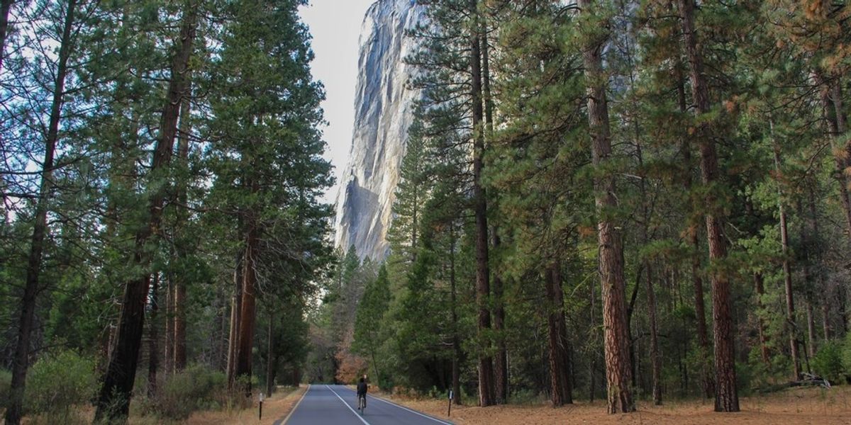
Seorang pengendara sepeda menikmati pemandangan El Cap yang menjulang tinggi di pangkuan sepeda Lembah Yosemite(Foto oleh Aron Bosworth)

Loop Sepeda Yosemite Vally

Menjelajahi Lembah Yosemite dengan sepeda membuka banyak sekali peluang yang tidak dapat diperoleh dengan mobil. Selain memiliki persediaan tempat parkir sepeda yang tak ada habisnya (Anda dapat melakukan hampir di mana saja), Anda memiliki kebebasan udara terbuka untuk menikmati pemandangan sambil berlayar dan dapat berhenti sejenak untuk menjelajahi padang rumput yang indah, menatap granit monolit, atau hangatkan diri di depan api unggun di Ahwahnee Hotel yang bersejarah.

  • PROS: Cara yang bagus untuk melihat-lihat dan menjelajahi landmark lembah. Tidak harus berurusan dengan parkir.
  • CONS: Jaringan jalur sepeda terbatas. Harus berbagi jalan dengan mobil.
  • WILAYAH: Yosemite + Central Sierra, CA
  • KONGESI: Sedang
  • MUSIM YANG DIUTAMAKAN: Musim Semi, Musim Panas, Musim Gugur
  • HARI PENGGUNAAN / PARKING PASS DIPERLUKAN: National Park Pass
  • JARAK TOTAL: 20,50 mi (32,99 km)
  • KESULITAN TERRAIN: HIJAU
  • TRAILHEAD ELEV .: 4.000 kaki (1.219 m)
  • NET ELEV. KEUNTUNGAN: 50 kaki (15 m)
  • TRAIL PENGGUNAAN: Hiking, Bersepeda
  • JENIS JALUR: Loop
  • ANJING DIIZINKAN ?: Tidak

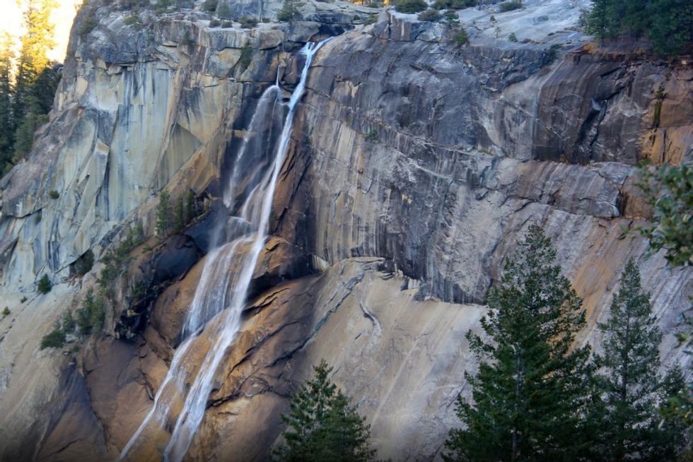
Nevada Falls(Aron Bosworth)

Nevada Falls melalui Giant Staircase Loop

Saat pertama kali melihat Tangga Raksasa Yosemite, orang dapat membayangkan bagaimana bagian dari Ngarai Sungai Merced ini mendapatkan namanya. Tangga Raksasa mengacu pada sepasang anak tangga granit besar yang menciptakan jurang setinggi 2.000 kaki antara Lembah Yosemite Kecil dan lantai utama Lembah Yosemite. Menambah lanskap dramatis ini, Sungai Merced merosot di atas tepian dan menciptakan dua air terjun spektakuler: Vernal Fall setinggi 317 kaki dan Air Terjun Nevada setinggi 594 kaki.

  • PROS: Banyak air terjun. Tampilan fenomenal kubah glasial Yosemite.
  • CONS: Bagian jalan yang lebih rendah bisa ramai.
  • WILAYAH: Yosemite + Central Sierra, CA
  • KONGESI: Sedang
  • MUSIM YANG DIUTAMAKAN: Musim Semi, Musim Panas, Musim Gugur
  • HARI PENGGUNAAN / PARKING PASS DIPERLUKAN: National Park Pass
  • JARAK TOTAL: 6,30 mi (10,14 km)
  • TRAILHEAD ELEV .: 4.000 kaki (1.219 m)
  • NET ELEV. KEUNTUNGAN: 1.090 kaki (332 m)
  • TRAIL PENGGUNAAN: Hiking, HorsebackT
  • JENIS RAIL: Ada-dan-kembali / Loop
  • ANJING DIIZINKAN: Tidak

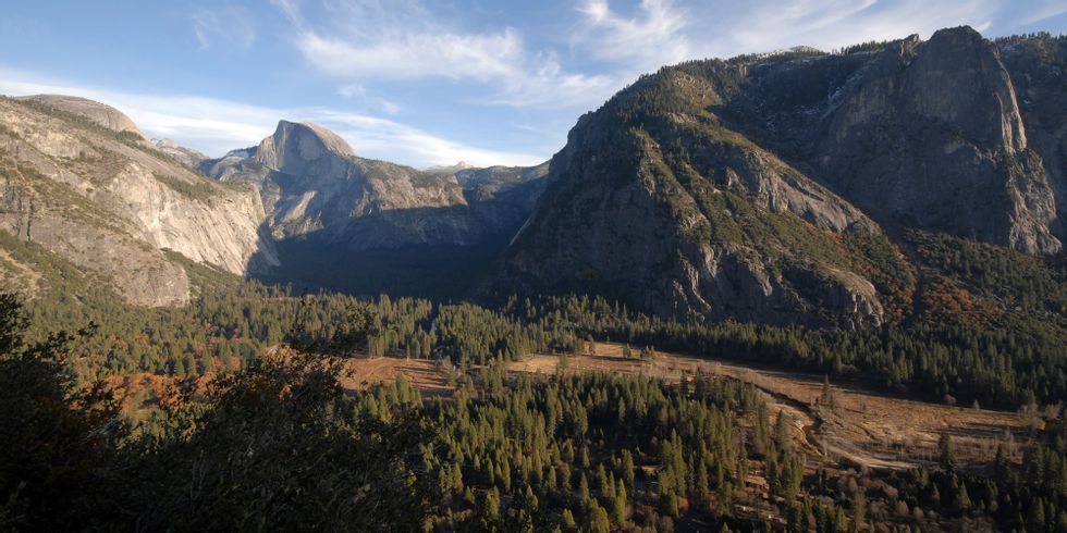
Pemandangan Lembah Yosemite dari Columbia RockFoto oleh Tyson Gillard

Columbia Rock Hike

Berangkat dari tepi utara Lembah Yosemite, pendakian ke Columbia Rock berakhir di lokasi yang ideal untuk duduk, mengatur napas, melepas penat dari hari, dan menikmati pemandangan lembah yang mengesankan saat matahari terbenam.

  • PROS: Pemandangan Lembah Yosemite yang indah.
  • CONS: Jalan setapak yang sulit dan curam.
  • WILAYAH: Yosemite + Central Sierra, CA
  • KONGESI: Tinggi
  • MUSIM YANG DIUTAMAKAN: Musim Dingin, Musim Semi, Musim Panas, Musim Gugur
  • HARI PENGGUNAAN / PARKING PASS DIPERLUKAN: National Park Pass
  • JARAK TOTAL: 3,00 mi (4,83 km)
  • TRAILHEAD ELEV .: 3.967 kaki (1.209 m)
  • NET ELEV. KEUNTUNGAN: 1.000 kaki (305 m)
  • KEGUNAAN TRAIL: Hiking
  • JENIS JALUR: Di sana-dan-belakang
  • ANJING DIIZINKAN: Tidak

Hotel Ahwahnee

The Ahwahnee Hotel (dengan senang hati tidak lagi disebut Majestic Yosemite Hotel) di Taman Nasional Yosemite sering disebut sebagai ratu penginapan taman nasional. Dinamai setelah penduduk asli Amerika Miwok yang mendiami Lembah Yosemite (“Ahwahnee” berarti tempat mulut menganga), hotel ini bisa dibilang representasi termegah dari gaya parkitecture Amerika yang begitu menyebar di antara struktur taman nasional andalan yang dibangun pada awal abad ke-20. Meskipun hotel itu sendiri adalah keajaiban arsitektur, kombinasi dari pengaturan Yosemite yang megah di hotel dan arsitektur yang terinspirasi oleh alamlah yang membedakannya.

  • PROS: Arsitektur pondok yang mengesankan. Penginapan.
  • CONS: Sulit untuk parkir selama peak season.
  • WILAYAH: Yosemite + Central Sierra, CA
  • KONGESI: Tinggi
  • MUSIM YANG DIUTAMAKAN: Musim Dingin, Musim Semi, Musim Panas, Musim Gugur
  • HARI PENGGUNAAN / PARKING PASS DIPERLUKAN: National Park Pass
  • POIN MINAT: Landmark bersejarah, Sudut Pandang
  • ANJING DIIZINKAN: Tidak

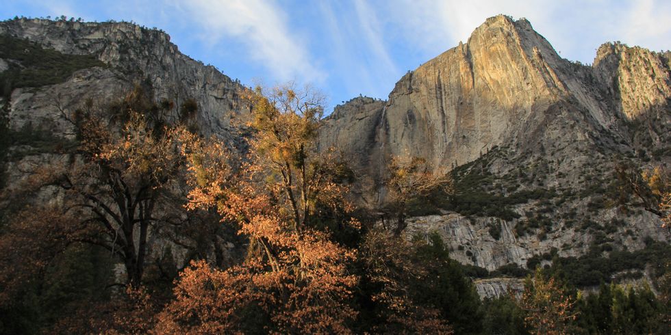
Warna musim gugur di bawah Air Terjun YosemiteFoto oleh Aron Bosworth
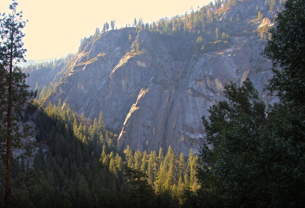
Air Terjun Yosemite Bawah

Air Terjun Yosemite Bawah merupakan tetes terakhir dari air terjun yang sangat besar Air Terjun Yosemite, air terjun tertinggi di Amerika Serikat. Sementara bagian atas air terjun, Air Terjun Yosemite Atas, menerima sebagian besar perhatian (dimengerti begitu dengan setetes 1.430 kaki), adik laki-laki itu tidak ada yang bisa dicemooh dengan ketinggian 320 kaki dari atas ke bawah.

  • PROS: Akses air terjun yang mudah. Pemandangan Half Dome yang mengesankan dari dasar air terjun.
  • CONS: Kerumunan.
  • WILAYAH: Yosemite + Central Sierra, CA
  • KONGESI: Tinggi
  • MUSIM YANG DIUTAMAKAN: Musim Dingin, Musim Semi, Musim Panas, Musim Gugur
  • HARI PENGGUNAAN / PARKING PASS DIPERLUKAN: National Park Pass
  • POIN MINAT: Sudut pandang, Hutan tua, Air terjun
  • ANJING DIIZINKAN: Tidak

(Aron Bosworth)

Lingkaran Danau Cermin

Terletak di sudut paling timur Lembah Yosemite dekat muara Ngarai Tenaya, Mirror Lake dibentuk oleh dasar danau dangkal di mana air Sungai Tenaya mengalir. Jalur melingkar datar yang mengelilingi danau dan berlanjut ke timur menuju Ngarai Tenaya memberi pengunjung kesempatan untuk menjelajahi sudut taman yang tenang dan tenteram ini.

  • PROS: Kaya akan satwa liar. Mendaki datar.
  • CONS: Tidak ada.
  • WILAYAH: Yosemite + Central Sierra, CA
  • KONGESI: Sedang
  • MUSIM YANG DIUTAMAKAN: Musim Semi, Musim Panas, Musim Gugur
  • HARI PENGGUNAAN / PARKING PASS DIPERLUKAN: National Park Pass
  • JARAK TOTAL: 4,20 mi (6,76 km)
  • TRAILHEAD ELEV .: 4.000 kaki (1.219 m)
  • NET ELEV. KEUNTUNGAN: 100 kaki (30 m)
  • KEGUNAAN TRAIL: Hiking
  • JENIS JALUR: Loop
  • ANJING DIIZINKAN: Tidak

Bumi Perkemahan Upper Pines

Upper Pines Campground adalah salah satu dari dua perkemahan yang terletak di Lembah Yosemite yang tetap buka sepanjang tahun. Ini adalah satu-satunya pilihan musim dingin yang terbuka untuk mobil, trailer, dan berkemah RV; Camp 4 buka sepanjang musim dingin, tetapi ini adalah perkemahan berjalan kaki khusus tenda. Upper Pines terdiri dari 238 situs yang tersebar di enam lingkaran, yang semuanya berada di bawah kanopi pinus ponderosa dan dupa cedar. Pepohonannya indah, tetapi menghalangi pemandangan granit sekitarnya yang menakjubkan. Perkemahan ini terletak di dekat beberapa jalur pendakian terbaik di lembah, dan hanya berjarak berjalan kaki dari Happy Isles Trailhead dan akses ke Vernal Fall dan Nevada Fall.

  • PROS: Buka di musim dingin. Dalam jarak berjalan kaki ke beberapa jalan setapak Yosemite.
  • CONS: Tempat perkemahan saling berdekatan.
  • WILAYAH: Yosemite + Central Sierra, CA
  • KONGESI: Tinggi
  • MUSIM YANG DIUTAMAKAN: Musim Dingin, Musim Semi, Musim Panas, Musim Gugur
  • BIAYA KAMP: $ 20
  • HARI PENGGUNAAN / PARKING PASS DIPERLUKAN: National Park Pass
  • TENDA / SITUS MOBIL: 238
  • TABEL PICNIC: Ya
  • ANJING DIIZINKAN: Ya

(Aron Bosworth)

Setelah Enam

After Six adalah permainan klasik Yosemite 5.7 dengan lemparan enam nada yang telah lama menjadi favorit di antara kelompok pendakian gratis yang tidak terlalu banyak waktu di Lembah Yosemite. Terletak di ujung barat Manure Pile Buttress, pendakian populer bagi mereka yang mencari salah satu rute Yosemite yang lebih mudah (ini adalah pengantar yang baik untuk pendakian tradisional multi-pitch Yosemite 5.7) atau untuk pendakian yang membutuhkan komitmen kurang dari sehari penuh . Rute naik 600 kaki ke atas lempengan granit Penahan Tumpukan Kotoran dalam serangkaian retakan sudut rendah dan bagian muka. Tepian penambatan besar sering terjadi di seluruh dan menawarkan banyak tempat untuk istirahat untuk camilan dan menikmati pemandangan Lembah Yosemite yang spektakuler.

  • PROS: Pendakian gratis 5,7 setengah hari. Mudah turun dengan berjalan kaki.
  • CONS: Potensi untuk membentuk barisan pada akhir pekan yang padat.
  • WILAYAH: Yosemite + Central Sierra, CA
  • KONGESI: Sedang
  • MUSIM YANG DIUTAMAKAN: Musim Semi, Musim Panas, Musim Gugur
  • HARI PENGGUNAAN / PARKING PASS DIPERLUKAN: National Park Pass
  • TRAILHEAD ELEV .: 4.000 kaki (1.219 m)
  • NET ELEV. KEUNTUNGAN: 600 kaki (183 m)
  • JENIS JALUR: Di sana-dan-belakang
  • ANJING DIIZINKAN: Tidak
  • PERALATAN YANG DIREKOMENDASIKAN: Harness, Rope, Anchors, Other
  • PITCH PALING TEKNIS: Kelas IV

Tampilan Terowongan

Mungkin dibuat paling terkenal oleh Ansel Adams *, pemandangan Lembah Yosemite dari Tunnel View dapat dikenali di seluruh dunia, terlepas dari apakah Anda pernah menginjakkan kaki di Taman Nasional Yosemite.

  • PROS: Sudut pandang Lembah Yosemite yang ikonik.
  • CONS: Kerumunan.
  • WILAYAH: Yosemite + Central Sierra, CA
  • KONGESI: Tinggi
  • MUSIM YANG DIUTAMAKAN: Musim Dingin, Musim Semi, Musim Panas, Musim Gugur
  • HARI PENGGUNAAN / PARKING PASS DIPERLUKAN: National Park Pass
  • POIN BUNGA: Sudut Pandang
  • ANJING DIIZINKAN: Ya

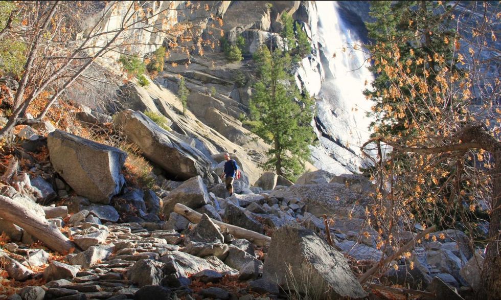
Mendaki di bawah Air Terjun Nevada. (Aron Bosworth)

Taft Point

Dengan lebih sedikit ketenaran dan lebih sedikit pengunjung daripada di sekitarnya Titik Gletser, Taft Point adalah tebing pemandangan lain yang terletak di tepi selatan Yosemite. Menjulang 3.500 kaki di atas dasar lembah, Taft Point sebenarnya 300 kaki lebih tinggi dari Glacier Point. Tidak adanya pagar pembatas memberi tanjung granit ini perasaan yang lebih liar dan terbuka daripada tanjungnya yang terletak beberapa mil ke timur di Glacier Point Road.

  • PROS: Mendaki di sepanjang tepi tepi selatan. Celah. Pemandangan mendebarkan.
  • KONTRA: Eksposur mungkin bermasalah bagi beberapa orang.
  • WILAYAH: Yosemite + Central Sierra, CA
  • KONGESI: Sedang
  • MUSIM YANG DIUTAMAKAN: Musim Panas, Musim Gugur
  • HARI PENGGUNAAN / PARKING PASS DIPERLUKAN: National Park Pass
  • JARAK TOTAL: 2,20 mi (3,54 km)
  • TRAILHEAD ELEV .: 7.740 kaki (2.359 m)
  • NET ELEV. KEUNTUNGAN: 230 kaki (70 m)
  • KEGUNAAN TRAIL: Hiking
  • JENIS JALUR: Di sana-dan-belakang
  • ANJING DIIZINKAN: Tidak

Titik Gletser

Kemungkinan Anda pernah mendengar tentang Glacier Point. Ini salah satu pemandangan yang paling banyak difoto dan sudut pandang yang lebih terkenal di negara ini. Presiden Teddy Roosevelt dan John Muir memiliki foto terkenal yang dibuat dari titik perjalanan Presiden ke Yosemite pada tahun 1903. Perjalanan ini mengakibatkan Lembah Yosemite dimasukkan dari kontrol negara ke dalam sistem Taman Nasional dan menerima perlindungan yang lebih besar.

  • PROS: Salah satu pemandangan terbaik dari Half Dome dan Lembah Yosemite timur. Akses mudah saat jalan terbuka. Ramah keluarga.
  • CONS: Kerumunan.
  • WILAYAH: Yosemite + Central Sierra, CA
  • KONGESI: Tinggi
  • MUSIM YANG DIUTAMAKAN: Musim Semi, Musim Panas, Musim Gugur
  • HARI PENGGUNAAN / PARKING PASS DIPERLUKAN: National Park Pass
  • POIN BUNGA: Sudut Pandang
  • ANJING DIIZINKAN: Tidak

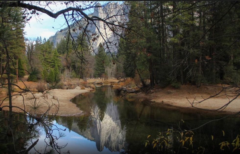
Batu Sentinel terpantul di Sungai Merced yang jernih. (Aron Bosworth)

Vernal Falls Hike melalui Mist Trail

Di bagian bawah dari dua anak tangga yang membentuk Tangga Raksasa, Air Terjun Vernal melalui Jalur Kabut menjelajahi hamparan Ngarai Sungai Merced saat ia naik dari dasar lembah dan naik ke atas Air Terjun Vernal. Mendaki adalah pilihan yang bagus di sana-dan-kembali jika Anda terbatas waktu atau tertarik dengan pemanasan sebelum berangkat pada pendakian di tempat yang lebih tinggi seperti Glacier Point melalui 4-Mile Trail dan Jalur Air Terjun Yosemite.

  • PROS: Air Terjun. Dapat dikombinasikan dengan pendakian loop yang lebih lama ke Nevada Falls.
  • CONS: Banyak orang di bagian bawah Mist Trail.
  • WILAYAH: Yosemite + Central Sierra, CA
  • KONGESI: Tinggi
  • MUSIM YANG DIUTAMAKAN: Musim Semi, Musim Panas, Musim Gugur
  • HARI PENGGUNAAN / PARKING PASS DIPERLUKAN: National Park Pass
  • JARAK TOTAL: 2,70 mi (4,35 km)
  • TRAILHEAD ELEV .: 4.000 kaki (1.219 m)
  • NET ELEV. KEUNTUNGAN: 1.055 kaki (322 m)
  • KEGUNAAN TRAIL: Hiking
  • JENIS JALUR: Di sana-dan-belakang
  • ANJING DIIZINKAN: Tidak

Half Dome Hike melalui John Muir Trail

Half Dome Hike di Taman Nasional Yosemite adalah salah satu yang paling ikonik dan menantang di Amerika Serikat. Pendakian ini akan menguji Anda secara fisik dan mental saat Anda mendaki seperempat mil terakhir jalan setapak dan mendaki sisi terjal Half Dome menggunakan kabel yang dibaut. Mendaki ikon Yosemite ini menampilkan pemandangan gunung dan lembah yang luar biasa, bunga liar, air terjun, sequoia tua, dan sekilas menarik dari beberapa sejarah geologi paling dinamis California.

  • PROS: Pemandangan bagus. Bunga liar. Air terjun. Sequoia raksasa.
  • CONS: Kerumunan besar. Badai petir sore di musim panas.
  • WILAYAH: Yosemite + Central Sierra, CA
  • KONGESI: Tinggi
  • MUSIM YANG DIUTAMAKAN: Musim Panas, Musim Gugur
  • HARI PENGGUNAAN / PARKING PASS DIPERLUKAN: National Park Pass
  • JARAK TOTAL: 16,50 mi (26,55 km)
  • TRAILHEAD ELEV .: 4.000 kaki (1.219 m)
  • NET ELEV. KEUNTUNGAN: 4.836 kaki (1.474 m)
  • TRAIL PENGGUNAAN: Hiking, Menunggang kuda
  • JENIS JALUR: Di sana-dan-belakang
  • ANJING DIIZINKAN: Tidak

.

Source link

9 Taman Nasional: Menjelajahi hutan, gunung berapi, gurun + pulau California

California memiliki — menghitungnya — sembilan taman nasional, yang terbanyak di antara negara bagian mana pun di AS.

Sehubungan dengan bagian-bagian Pasifik Barat Laut dan mungkin bagian-bagian dari Pantai Timur, tidak ada tempat lain di negara ini yang menunjukkan jenis keanekaragaman ekologi yang dapat ditemukan di California. Kita memiliki semuanya: hutan hujan sedang yang menjulang tinggi dengan organisme arboreal terbesar di planet ini; titik terendah di Amerika Utara, gurun pasir yang kering dan gersang; lembah granit-potong gletser ikonik dan gunung berapi aktif; dan pantai berpasir dan pulau-pulau Pasifik.


Di sini kami memberikan Anda sorotan dari masing-masing dari sembilan taman nasional California. Jika Anda berencana untuk mengunjungi selama pandemi Covid-19, silakan periksa situs web taman resmi, yang disediakan di bawah ini, untuk pembaruan dan pedoman terbaru. Pastikan untuk mengemas topeng Anda.

Taman Nasional dan Negara Bagian Redwood

Taman Nasional dan Negara Bagian Redwood terkenal dengan pohon arboreal raksasa, Sequoia semperviron, kayu merah raksasa, yang tumbuh hingga ketinggian di atas 300 kaki dan usia lebih dari 2.000 tahun. Kondisi di sini lebih baik daripada di tempat lain di dunia untuk raksasa hutan, dan pohon-pohon yang tumbuh di sini termasuk yang tertinggi di dunia.

Koleksi taman meliputi Taman Nasional Redwood, dan di sebelah utara, Prairie Creek, Del Norte, dan Taman Negara Bagian Jedediah Smith. Kebun redwood yang paling terkenal tumbuh di Taman Nasional Redwood dan Taman Negara Bagian Jedediah Smith — Hutan Pohon Tinggi, Hutan Titans dan Stout Grove. Tall Trees Grove di Redwood National Park, rumah dari pohon tertinggi dunia yang pernah tercatat, dapat diakses dari bawah melalui Redwood Creek Trail atau lebih tinggi melalui Dolason Prairie Trail, yang menawarkan para pejalan kaki kesempatan untuk mengalami perspektif berbeda dari Taman Nasional Redwood , Dimulai di luar hutan di tanah bekas peternakan. Grove of the Titans tumbuh di lokasi yang dirahasiakan di Taman Negara Bagian Jedediah Smith, tetapi Stout Grove adalah pendakian singkat di atas Sungai Smith dari pusat pengunjung.

Tapi jangan lewatkan hutan untuk pepohonan. Lonjakan pantai dan ngarai di taman juga memiliki banyak hal yang ditawarkan — Gold Bluffs Beach dan Fern Canyon khususnya, di mana Anda dapat melihat hutan dengan segala kemegahannya.

* Beberapa pusat pengunjung, tempat parkir, dan kamar kecil tetap ditutup karena Covid-19. Untuk pembaruan terbaru, buka nps.gov/redw.

Taman Nasional Yosemite

Itu John Muir Trail adalah salah satu cara terbaik untuk mengalami Taman Nasional Yosemite. Puncak granit dan kolam alpine paling baik dialami saat berada di jalan setapak, di mana makanan dikemas dan dimasak saat matahari terbenam dan pemandangannya terlihat setelah seharian berjalan melintasi beberapa pedalaman terbaik di dunia. Yang mengatakan, izin bisa sulit didapat, jadi beberapa dari kita harus melihat cocok untuk menjelajahi taman dengan cara lain.

Bagian selatan Yosemite paling mudah diakses, lebih luas daripada bagian utara, dan secara umum memiliki pemandangan taman yang paling dikenal. Tiga kenaikan daftar bucket termasuk Mendaki Half Dome, pendakian terkenal dengan KTT berbantuan kabel, itu Cathedral Lakes Hike dan Yosemite Falls Trail, yang paling baik dikunjungi selama limpasan musim semi ketika 2.425 kaki Air Terjun Yosemite berada di puncaknya.

* Yosemite terbuka selama Covid-19 berdasarkan reservasi saja. Untuk memesan, dan untuk pembaruan serta batasan terbaru, buka nps.gov/yose.

Taman Nasional Sequoia dan Kings Canyon

Berdampingan, Taman Nasional Sequoia dan Kings Canyon memiliki 800.000 hektar dan 800 mil jalur hiking untuk dinikmati. Seperti Taman Nasional dan Negara Bagian Redwood, Taman Nasional Sequoia dan Kings Canyon terkenal dengan pohon-pohon besar yang tumbuh di hutan mereka, dan taman-taman itu dibuat dengan tujuan untuk melestarikan kebun di mana mereka tumbuh. Sementara kayu merah pantai terkenal karena ketinggiannya, Sequanteadendron giganteum yang tumbuh di bagian Sierra Nevadas ini terkenal karena ketebalannya, dan pohon terbesar di dunia berdasarkan volume tumbuh di sini.

Jenderal Sherman adalah pohon yang dipertanyakan, dan tumbuh di Taman Nasional Sequoia. Dekat Hutan Raksasa menampung beberapa pohon terbesar di dunia. Moro Rock memberikan pemandangan menakjubkan dari kaki bukit dan formasi granit; pasangkan dengan Crescent Meadow, yang oleh John Muir disebut “Gem of the Sierra,” di kepala High Sierra Trail.

Taman Nasional Kings Canyon mungkin disebut “Yosemite Kecil” karena lembah-lembah dan dinding granitnya yang berukir glasial. Lebih banyak raksasa hutan tumbuh di Grant Grove, tempat tumbuh pohon terbesar ketiga berdasarkan volume, General Grant Tree. Road’s End, yang meliputi Cedar Grove, South Fork Kings River, dan Zumwalt Meadow, adalah tempat yang tepat untuk berkenalan dengan taman. Beberapa kenaikan panjang dimulai di sini, termasuk jalur ke Mist Falls dan Cedar Grove Abaikan. Zumwalt Meadow memiliki pemandangan luas dan menampilkan pemandangan ngarai yang menakjubkan, formasi granit besar yang menjulang di kedua sisi ngarai.

* Pemesanan diperlukan untuk berkemah; untuk pembaruan terbaru selama pandemi, buka nps.gov/seki.

Taman Nasional Death Valley

Sulit untuk percaya itu Taman Nasional Death Valley adalah sebuah danau hanya 20.000 tahun yang lalu, tidak lebih dari sekejap mata dalam waktu geologis. Saat ini, taman ini mendapatkan namanya sebagai salah satu tempat terpanas, terkering, dan paling terpencil di Amerika Utara, tetapi jangan biarkan itu membuat Anda kecil hati.

Penjelajah taman harus mengingat bahwa destinasi tersebar, dan fasilitas hanya tersedia di sepanjang Highway 190. Furnace Creek adalah lokasi sentral untuk memulai penjelajahan taman, dan area ini mencakup beberapa atraksi taman yang paling menarik. Formasi garam dari Lapangan Golf Setan adalah dunia lain, dan Natural Bridge Canyon fitur lengkungan yang terbentuk erosi.

Beyond Furnace Creek, Kastil Scotty adalah tengara yang menakjubkan dari masa lalu Death Valley. Kawah Ubehebe di daerah Grapevine adalah contoh mencolok dari masa lalu gunung berapi Death Valley.

Sudah dikatakan sepanjang sejarah bahwa pengunjung harus membalikkan hari dan malam mereka ketika bepergian di padang pasir, apakah Sahara atau Atacama, dan ada beberapa pengertian bagus dalam rekomendasi itu di sini juga. Perjalanan waktu malam di Death Valley — jauh dari cahaya urbanitas — akan menikmati kubah panorama bintang-bintang yang tidak tersedia di beberapa bagian yang lebih dipengaruhi oleh kemajuan umat manusia. Ini juga tidak akan terlalu panas.

* Pusat pengunjung dan beberapa tempat perkemahan tetap ditutup karena Covid-19. Untuk pembaruan terbaru, kunjungi nps.gov/deva.

Taman Nasional Joshua Tree

Beberapa pemandangan seperti warp Taman Nasional Joshua Tree, Limpahan, lanskap mimpi Seusia yang memperdaya imajinasi. Ada beberapa cara terbaik untuk menjelajahi taman, dan keduanya dilakukan dengan berjalan kaki: hiking ke tempat-tempat menarik dan mendaki.

Sementara kenaikan terbaik di Joshua Tree memamerkan yang terbaik dari batuan, terutama di Jalur Lintas Alam Arch Rock dan Jejak Alam Lembah Tersembunyi, flora paling menarik dapat ditemukan saat berada di jalan. Itu Taman Cholla Cactus menampilkan salah satu penghuni tanaman taman paling aneh dan lucu, dan Patch Ocotillo di Pinto Basin terbakar setelah hujan ketika ocotillo cactus setinggi 30 kaki mekar.

Ada 8.000 rute pendakian di Joshua Tree. Singkatnya, ini adalah kiblat pendakian. Tebing di Persimpangan adalah tempat klasik untuk memulai, yang disebut tempat kelahiran pendakian di Joshua Tree, dengan rute yang berkisar dari 5,3 hingga 5,12b non-teknis. Lost Horse, Real Hidden Valley, dan Indian Cove pasti akan membuat Anda sibuk juga, tapi ini masalahnya: Berkemah terbatas di Joshua Tree, jadi Anda harus memesan terlebih dahulu, tiba lebih awal, atau memo untuk apa yang tersisa. Ada juga tanah BLM di daerah tersebut untuk berkemah primitif.

* Pameran museum dan pusat pengunjung sementara ditutup karena Covid-19. Untuk pembaruan terbaru, buka nps.gov/jotr.

Taman Nasional Channel Island

Kepulauan Channel menawarkan kesempatan tak tertandingi untuk menemukan pengasingan di lingkungan yang unik. Hanya ada beberapa taman nasional pulau di Amerika Serikat yang bersebelahan, dan Kepulauan Channel adalah satu-satunya di California. Taman ini terdiri dari lima pulau: Anacapa, Santa Cruz, San Miguel dan Santa Rosa berkerumun di barat Santa Monica, dan Santa Barbara, terletak sekitar 50 mil di sebelah tenggara Pulau Santa Rosa.

Meskipun lokasinya terpencil, Kepulauan Channel memiliki banyak hal untuk ditawarkan. Tempat perkemahan primitif tersedia di setiap pulau yang terbuka untuk pejalan kaki dan pelaut. Tebing dan ngarai terjal, padang rumput seperti padang rumput, bunga liar, dan pinus Torrey yang langka dapat ditemukan di sepanjang jalur hiking, terutama di pulau-pulau Santa Rosa dan Santa Cruz. Lihatlah Water Canyon dan Carrington Point di Pulau Santa Rosa, dan Scorpion Canyon dan Scorpion Anchorage selama mekar bunga liar di Pulau Santa Cruz. Pantai Scorpion dan Pulau Santa Cruz timur adalah tujuan kelas dunia untuk kayak laut. Menyelam dan snorkeling adalah yang terbaik di pulau-pulau Santa Barbara, Anacapa dan Santa Cruz, di mana kondisi angin lebih tenang daripada Santa Rosa dan San Miguel.

Perencanaan terlebih dahulu diperlukan untuk perjalanan ke Kepulauan Channel, yang hanya dapat diakses oleh kapal pemegang konsesi dan dapat ditempuh hanya dengan berjalan kaki, kayak, atau perahu. Tidak ada sepeda yang diizinkan. Tidak ada fasilitas di pulau. Tidak ada toko kelontong atau penyewaan peralatan. Setelah Anda berada di sana, Anda sendirian, jadi penting untuk merencanakan ke depan dan bersiaplah. Selain itu, taman berfungsi sebagai kawasan konservasi laut dan satwa liar, dan beberapa daerah sepenuhnya dilarang bepergian atau dikunjungi dan harus dihindari.

* Kelima pulau taman terbuka untuk dikunjungi tetapi pusat pengunjung daratan tetap ditutup karena Covid-19. Untuk pembaruan terbaru, buka nps.gov/chis.

Taman Nasional Gunung Berapi Lassen

Salah satu taman yang paling jarang dikunjungi dalam sistem taman, Taman Nasional Gunung Berapi Lassen melestarikan warisan gunung berapi Lassen Peak, gunung berapi paling selatan di Range Cascade, dan nenek moyangnya yang lama terkikis, Gunung Tehama. Bukti adanya titik panas di bawah Lassen berlimpah di taman, dengan beberapa geyser, kolam mendidih dan lubang uap untuk dikunjungi. Dari area panas bumi, Bumpass Hell paling mengesankan dengan inset kolam kecil di antara fumarol, lubang uap, dan kolam mendidih yang dilapisi emas bodoh. Devil’s Kitchen adalah kenaikan yang lebih lama di sekitar 4 mil melewati mudpots, fumaroles dan Hot Springs Creek.

Di luar aktivitas panas bumi, Lassen adalah lingkungan pegunungan alpine yang indah dengan banyak petualangan yang ditawarkan. Di musim panas, jelajahi sekitar Danau Manzanita. Pendakian Danau Echo menawarkan pemandangan yang indah Puncak Lassen, yang juga merupakan pertemuan yang sangat direkomendasikan.

Kings Creek adalah tujuan hiking yang populer dengan riam yang indah. Lassen mendapat lebih banyak salju daripada Shasta di dekatnya dengan basisnya yang kadang-kadang mencapai 30 kaki, menjadikan area tersebut sebagai area rekreasi musim dingin yang utama. Ski lintas alam dan kegiatan sepatu salju terletak di sekitar Daerah Rekreasi Musim Dingin Barat Daya. Daerah panas bumi sama mencoloknya di musim dingin, dan banyak wajah Lassen, termasuk wajah tenggara, Terbuka untuk bermain ski dan snowboarding di pedalaman.

* Sebelum mengunjungi, periksa penutupan jalur dan danau di nps.gov/lavo.

Taman Nasional Pinnacles

Pada tahun 2015, sekitar 206.000 orang mengunjungi Pinnacles National Park, salah satu taman yang paling jarang dikunjungi dalam sistem Layanan Taman Nasional dan yang terbaru dari California, didirikan dari sebuah monumen nasional pada tahun 2012. Sebagian besar taman tersebut ditunjuk sebagai hutan belantara untuk berbagai program termasuk pemulihan California. condor, dan Pinnacles adalah salah satu dari empat tempat di mana condor captive dilepaskan ke alam liar. Sekitar 60 condor terbang di atas taman hari ini.

Secara geologis, Pinnacles adalah bidang lava yang kasar, bagian dari gunung berapi yang sudah lama punah yang bergeser 200 mil dari lokasi aslinya di sepanjang Patahan San Andreas. Taman ini ditandai dengan puncak-puncak batu yang menarik pendaki di bulan-bulan musim gugur dan musim dingin dan gua-gua talus yang, selama musim panas, adalah pelarian dari panasnya musim panas. Untuk pemanjat, rute yang dibaut dan tidak dikunci berkisar dari 5,4 hingga 5,13a dan lebih jauh, tetapi diperingatkan terlebih dahulu: Rasa yang didapat, Pinnacles terkenal karena batuan lepas, dan tebing memerlukan pola pikir eksperimental tertentu untuk dipanjat. Sebelas spesies kelelawar menempati Gua Gulch Beruang di sisi timur taman dan Gua Balkon di sebelah barat, yang keduanya berusaha tetap terbuka selama 10 bulan dalam setahun. Ada juga jalur pendakian sepanjang 30 mil di daerah tersebut, yang memamerkan menara-menara berapi di taman itu — the Loop Puncak Tinggi dan Moses Springs Trail khususnya.

Pinnacles dapat diakses melalui California Route 146 baik di sisi timur atau barat taman, tetapi rute tidak terhubung dalam Pinnacles. Perhatikan juga itu Perkemahan Pinnacles adalah satu-satunya perkemahan di taman dan hanya dapat diakses oleh pintu masuk timur.

* Temukan pedoman untuk mengunjungi selama Covid-19 di nps.gov/pinn.

.

Source link